Historic River Travel Routes That Shaped Texas
Long before highways crossed the state, Texas’ rivers and river-adjacent trails served as lifelines for Indigenous communities, Spanish colonists, traders, settlers, and merchants. Many of these routes began as Native American pathways, later formalized into colonial roads like El Camino Real de los Tejas.
Strategic river crossings along the Medina, Trinity, Red River, and Buffalo Bayou shaped settlement patterns and commercial growth. From San Antonio’s springs to Houston’s ship channel, waterways influenced how Texas developed economically and culturally.
Indigenous Canoe and Raft Travel Traditions
Long before European colonization, Native American groups navigated Texas waterways using dugout canoes and simple rafts. Along rivers such as the Brazos, Trinity, Red River, and Guadalupe, Indigenous communities used watercraft for fishing, trade, and seasonal movement.
Archaeological evidence and historical accounts describe hollowed-log canoes capable of transporting goods and people across river corridors. Coastal groups along the Gulf used shallow-draft watercraft to travel estuaries and bays.
These early navigation systems shaped later colonial and settlement routes. Spanish and Anglo settlers frequently followed established Indigenous pathways that paralleled rivers or crossed at known fords.
Spain’s Route Network: How El Camino Real Connected Colonial Texas
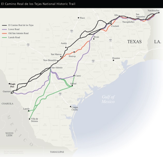
When French explorer René-Robert Cavelier, Sieur de La Salle, landed on the Texas coast in 1685, Spain intensified efforts to secure its northern frontier. The result was the expansion of El Camino Real de los Tejas, a network of trails linking Mexico’s interior to East Texas missions and presidios.
Rather than a single road, El Camino Real was a system of routes extending roughly 2,500 miles from central Mexico to Spanish settlements in present-day East Texas and Louisiana. Expeditions led by Alonso de León between 1686 and 1690 helped establish missions and reinforce Spanish presence.
The route facilitated trade, livestock movement, military travel, and religious missions. San Antonio de Béxar became a key hub along the corridor due to its reliable water supply and strategic location between the Rio Grande and East Texas settlements.
Today, portions of El Camino Real are recognized as a National Historic Trail, reflecting its importance in colonial Texas transportation.
Medina and Trinity River Crossings: Strategic Points on the Landscape
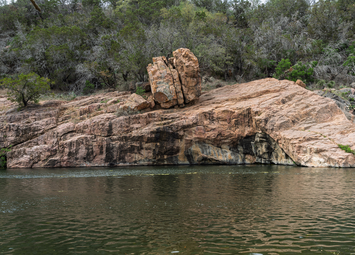
River crossings shaped the direction of early roads. The Medina River, west of San Antonio, featured natural fords used by Indigenous peoples long before Spanish arrival. Archaeological sites along the Medina have revealed evidence of long-term habitation, trade, and tool-making.
Spanish expeditions, including those of Alonso de León, utilized these crossings during late 17th-century exploration. Artifacts such as European trade beads and metal goods found near crossing sites illustrate early cultural exchange.
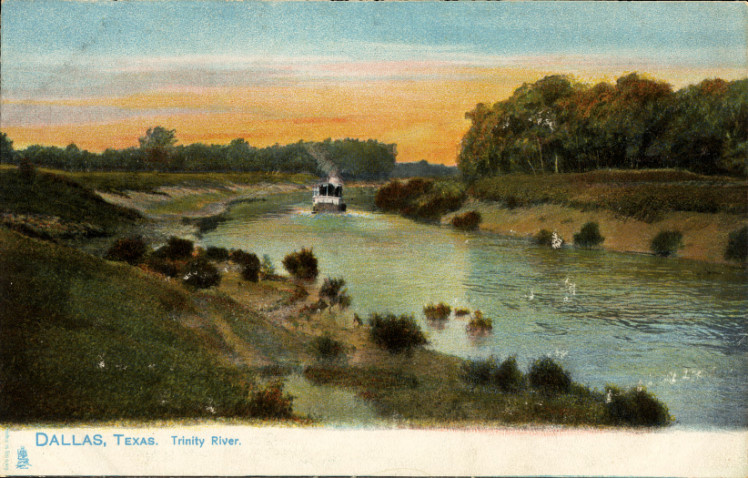
Similarly, the Trinity River in North Texas became a crucial crossing corridor for settlers moving westward in the 19th century. While less archaeologically dramatic than the Medina, Trinity River fords helped shape migration routes connecting East Texas settlements to the interior.
These river crossings were not merely obstacles—they determined where roads formed, towns developed, and commerce flowed.
The San Patricio Trail: Linking Coastal and Interior Texas
In the early 19th century, Irish colonists established the settlement of San Patricio near the Nueces River. A developing road—often referred to as the San Patricio Trail—connected the coastal region to San Antonio.
By the mid-1800s, stagecoach lines traveled between Corpus Christi and San Antonio, transporting mail, passengers, and goods. River crossings along the Nueces were critical to maintaining this route.
Security challenges, including conflicts with Native American groups and bandit activity, occasionally disrupted travel. Despite these risks, the route strengthened economic ties between South Texas coastal settlements and interior markets.
Trammel’s Trace: A Northern Migration Route
Trammel’s Trace was a key early 19th-century route connecting Arkansas to Nacogdoches in East Texas. Originally based on Native American trails, the path later became associated with Nicholas Trammell, a trader active in the region.
Stretching roughly 180 miles, the trace served as a corridor for settlers entering Mexican Texas after 1821. Figures such as Stephen F. Austin and Sam Houston traveled routes connected to this broader migration network.
Though parts of the trail have faded, remnants of wagon ruts remain visible in portions of East Texas. Trammel’s Trace helped channel immigration and commerce before formal road systems were established.
The Brazos River: Backbone of Austin’s Early Colonies
The Brazos River played a defining role in the establishment of Anglo-American settlement in Mexican Texas. When Stephen F. Austin brought the “Old Three Hundred” colonists to Texas in the 1820s, many settlements were established along the fertile Brazos River valley.
The river provided reliable water, rich alluvial soil for cotton cultivation, and transportation access for trade. Early towns such as San Felipe de Austin, Austin’s colonial capital, were strategically positioned near the Brazos to support agriculture and commerce.
Although the Brazos was not consistently navigable for large vessels, smaller craft and flatboats transported goods to the Gulf Coast. The river corridor became the agricultural heartland of early Texas settlement and laid the economic groundwork for the Republic of Texas.
The Colorado River: Shaping Central Texas Settlement
The Colorado River of Texas (not to be confused with the Colorado River of the Southwest) was instrumental in the development of Central Texas communities. Flowing from West Texas through Austin to Matagorda Bay, the river supported early ranching, farming, and transportation.
Austin itself was founded along the Colorado in 1839 when it was selected as the capital of the Republic of Texas. The river’s proximity provided water resources and access to interior trade routes. Although flooding limited large-scale navigation, the Colorado remained essential to settlement expansion and agricultural productivity.
In later decades, dam construction—including Longhorn Dam and Mansfield Dam—transformed the river into a managed water system that continues to sustain Central Texas growth.
San Antonio Springs: The Convergence Point
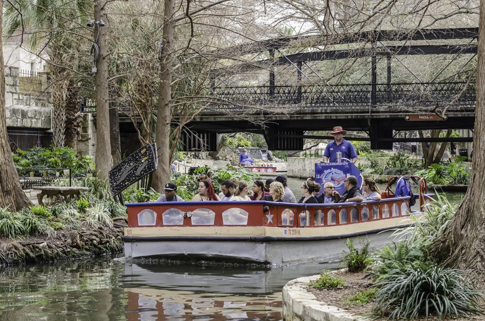
Reliable water dictated settlement. The springs along the San Antonio River—particularly San Pedro Springs—provided dependable year-round water access.
Archaeological evidence shows Indigenous peoples used the area for thousands of years prior to Spanish settlement. In 1718, Spanish colonists established Mission San Antonio de Valero and Presidio San Antonio de Béxar nearby, relying on spring-fed water.
The development of acequia irrigation systems distributed water to missions and agricultural lands, reinforcing San Antonio’s position as a transportation and settlement hub.
Red River Steamboats: Opening Northern Texas
In the early 19th century, the Red River became a commercial navigation route linking Texas to markets in Louisiana and beyond. A massive natural logjam known as the “Great Raft” once obstructed passage along portions of the river.
Federal efforts to remove the raft in the 1830s improved navigation, opening sections of the river to steamboat traffic. By the mid-1800s, the town of Jefferson, Texas, emerged as a major inland port.
Steamboats transported cotton, timber, and agricultural goods until railroad expansion reduced reliance on river navigation later in the century.
Buffalo Bayou: The Foundation of Houston’s Port
Houston’s origins are closely tied to Buffalo Bayou, which provided a navigable connection to Galveston Bay. Founded in 1836, Houston quickly grew as steamboats carried cotton and lumber through the bayou.
Federal dredging projects in the late 19th and early 20th centuries deepened the waterway. The opening of the Houston Ship Channel in 1914 transformed the bayou into a major deep-water port.
Today, the Port of Houston remains one of the busiest ports in the United States, reflecting how a modest bayou evolved into a global shipping hub.
Archaeological Evidence at River Crossings
River crossings across Texas have yielded artifacts spanning thousands of years. Archaeologists have discovered stone tools, ceramics, trade beads, and metal objects at sites along the Medina River and other crossings.
These findings demonstrate that river fords were gathering points for trade, travel, and cultural exchange. Sediment layers and preserved materials help researchers understand how Indigenous groups and European settlers used these corridors over time.
River travel routes were not accidental—they followed natural geography, water access, and trade opportunities that shaped Texas’ transportation evolution.
Regional Breakdown: How River Routes Differed Across Texas
Texas’ river travel routes varied significantly by region:
- East Texas: Dense forests and navigable rivers like the Red and Sabine supported steamboat trade and migration routes such as Trammel’s Trace.
- Gulf Coast: Buffalo Bayou and coastal waterways enabled maritime commerce and port development in Houston and Galveston.
- South Texas: The Medina and Nueces Rivers shaped Spanish colonial expansion and early ranching corridors.
- North Texas: Trinity River crossings guided westward migration and agricultural settlement patterns.
- Central Texas (Hill Country): The Brazos and Colorado Rivers anchored agricultural colonies and early republic governance.
This regional perspective highlights how geography dictated different forms of transportation and economic development across the state.