San Antonio River Walk History Explained

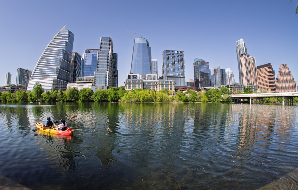
The San Antonio River Walk, one of Texas’s most recognizable attractions, grew from a practical flood-control project into a celebrated cultural destination. Today, the River Walk stretches for more than 15 miles along the San Antonio River, weaving through downtown, historic neighborhoods, museums, and mission sites.
Its development began after a devastating flood in 1921 prompted the city to rethink how the river could be managed. Architect Robert H. H. Hugman later proposed transforming the riverbanks into a pedestrian promenade, blending flood control with urban design.
Construction began during the Works Progress Administration (WPA) era in the late 1930s, creating the original downtown section of the River Walk. Over the following decades, expansions and redevelopment projects turned the river corridor into one of the most visited attractions in Texas.
Understanding the Different Sections of the River Walk
Today’s River Walk extends more than 15 miles along the San Antonio River and is typically divided into three main sections. Each offers a different atmosphere and experience.
Downtown Loop
The Downtown Loop is the original River Walk built during the WPA era between 1939 and 1941. This section forms a horseshoe-shaped bend of the river beneath downtown streets.
Visitors will find many of the River Walk’s most recognizable attractions here, including restaurants, historic bridges, hotels, and riverboat tours. Popular landmarks like Arneson River Theatre, La Villita Historic Arts Village, and Marriage Island are located within this central loop.
Museum Reach
Completed in 2009, the Museum Reach extends approximately four miles north from downtown. This section connects several major cultural destinations, including the San Antonio Museum of Art, the Witte Museum, the San Antonio Zoo, and the Pearl District.
Unlike the busy downtown loop, Museum Reach features public art installations, landscaped walkways, and quieter pedestrian paths, making it popular for walking and cycling.
Mission Reach
The Mission Reach extends roughly eight miles south of downtown, linking the River Walk to San Antonio Missions National Historical Park, a UNESCO World Heritage Site.
Completed in phases and finalized in 2013, this section focuses on ecosystem restoration and outdoor recreation, offering hiking trails, biking paths, and restored river habitats alongside historic mission landmarks.
Early Bridges and Spanish Colonial Settlement (18th Century)
The San Antonio River played a central role in the city’s early Spanish colonial settlement. Missions and military installations established along the river relied on bridges and irrigation systems to connect communities and support agriculture.
By the mid-18th century, bridges were constructed to link Mission San Antonio de Valero (the Alamo), Presidio San Antonio de Béxar, and nearby settlements across the river. These crossings allowed movement between religious missions, military facilities, and the growing civilian population.
Early Spanish engineers also developed acequias, irrigation canals that distributed river water to nearby fields. Portions of these historic waterways still exist today and are recognized as significant early infrastructure in San Antonio’s development.
The 1921 Flood That Changed the City
On September 9–10, 1921, intense rainfall caused catastrophic flooding in San Antonio. In parts of the city, more than 12 inches of rain fell in less than 24 hours, overwhelming creeks and waterways.
Floodwaters surged through downtown and surrounding neighborhoods, causing widespread destruction. Historical records report 51 deaths within San Antonio, with many additional fatalities across South Texas. Property damage in the city was estimated at about $5 million in 1921 dollars, an enormous loss for the time.
The disaster prompted city leaders to develop new flood-control strategies to prevent similar tragedies in the future.
Engineering Flood Protection: Olmos Dam and River Bypass
In response to the 1921 flood, San Antonio launched major flood-control projects. The most important was the construction of Olmos Dam, completed in 1926 on Olmos Creek north of downtown.
The dam was designed to hold back floodwaters before they could reach the city center. Engineers also developed additional drainage improvements and channels to redirect excess water during major storms.
These engineering efforts laid the groundwork for transforming the river corridor into a safer and more usable public space.
Robert Hugman’s Vision for a Riverfront Promenade (1929)
In 1929, architect Robert H. H. Hugman proposed an ambitious plan to transform the San Antonio River into a scenic pedestrian area called “The Shops of Aragon and Romula.”
Hugman envisioned stone bridges, landscaped walkways, restaurants, and shops lining the riverbanks below street level. His design incorporated Spanish-style architecture and intimate pathways inspired by European river cities.
Although the idea initially faced skepticism, Hugman continued advocating for the project throughout the 1930s until it gained support through federal New Deal programs.
WPA Workers Construct the Original River Walk (1939–1941)
Construction of the original River Walk began in 1939 with funding from the Works Progress Administration (WPA). Local leaders, including Congressman Maury Maverick and Mayor C. K. Quin, helped secure federal support for the project.
Workers dredged sections of the river and built stone pathways, bridges, staircases, and landscaped terraces along the downtown river loop.
Key features built during this period included:
- Arneson River Theatre, an outdoor performance venue
- Decorative stone bridges and stairways
- Walkways along the downtown river bend
The project was completed in 1941, marking the beginning of the River Walk as a public gathering place.
Key Landmarks Along the River Walk
Several historic sites and architectural features help define the character of the River Walk.
Arneson River Theatre
Located in La Villita Historic Arts Village, the Arneson River Theatre opened in 1941 as part of the original WPA construction. The outdoor amphitheater uniquely places the stage across the river from the audience seating area.
Today it hosts concerts, dance performances, and cultural festivals, continuing its role as one of the River Walk’s most distinctive performance venues.
La Villita Historic Arts Village
Adjacent to the River Walk, La Villita preserves one of San Antonio’s earliest neighborhoods. The area now operates as a historic arts district featuring artisan shops, galleries, and cultural spaces housed in restored 18th- and 19th-century buildings.
Marriage Island
Near the intersection of St. Mary’s Street and Navarro Street, Marriage Island is a small landscaped space along the river known for hosting weddings and proposals. The site gained popularity as a romantic location due to its quiet setting and river views.
Mid-Century Challenges and Limited Development
In the decades after World War II, the River Walk struggled to attract consistent attention and investment. Downtown development patterns shifted, and many businesses focused on street-level storefronts rather than river-level spaces.
Although the area remained a scenic feature of the city, the river corridor did not yet function as the major tourism destination it would later become.
Large events such as HemisFair ’68, held for San Antonio’s World’s Fair, helped bring renewed attention to the River Walk and surrounding downtown area.
Downtown Hotels and Tourism Expansion (Late 20th Century)
Beginning in the 1970s and 1980s, new hotels and restaurants began opening along the River Walk, helping transform it into a thriving hospitality district.
The opening of major properties such as the Hyatt Regency San Antonio in the early 1980s reinforced the River Walk as a key destination for visitors and conventions. Restaurants, shops, and entertainment venues gradually filled the river-level spaces envisioned decades earlier by Hugman.
Annual events such as the Holiday River Parade and seasonal festivals further strengthened the River Walk’s reputation as a centerpiece of San Antonio tourism.
Major Annual Events on the River Walk
Throughout the year, the River Walk serves as the setting for several major cultural celebrations that draw visitors from across Texas and beyond.
Fiesta San Antonio
Held each spring, Fiesta San Antonio is one of the city’s largest cultural festivals. The celebration includes parades, concerts, and community events throughout the city.
The Fiesta River Parade, held along the River Walk, features decorated floats traveling along the water while thousands of spectators gather along the walkways above.
Holiday River Parade
Each November, the Holiday River Parade marks the beginning of the River Walk’s Christmas season. Colorfully lit boats travel along the river while the surrounding walkways are decorated with thousands of lights and holiday displays.
The parade attracts large crowds and remains one of the most popular seasonal events in San Antonio.
Día de los Muertos Celebrations
In late October and early November, San Antonio hosts Día de los Muertos events honoring the Mexican tradition of remembering loved ones who have passed away.
River Walk celebrations often include altars, cultural performances, and decorative displays, reflecting the city’s strong Mexican and Mexican American cultural heritage.
Museum Reach and Mission Reach Expand the River Walk
Major expansion projects in the early 21st century significantly extended the River Walk beyond the downtown area.
Museum Reach (Opened 2009)
The Museum Reach project extended the river north from downtown toward the Pearl District, connecting cultural attractions such as:
- The Witte Museum
- San Antonio Museum of Art
- San Antonio Zoo
- The Pearl brewery redevelopment
The expansion added landscaped walkways, public art installations, and riverboat access.
Mission Reach (Completed 2013)
The Mission Reach ecosystem restoration extended the river south for approximately 8 miles, connecting the downtown River Walk to the San Antonio Missions National Historical Park.
This project restored natural river habitats while creating hiking and biking trails linking the historic missions.
San Pedro Creek Culture Park and Downtown Greenway Expansion
Another major waterway revitalization project began in 2016 with the development of San Pedro Creek Culture Park.
This project transformed a previously overlooked drainage channel into a landscaped urban park highlighting public art, native plants, and cultural history. The creek runs west of downtown and reflects the region’s Indigenous, Spanish, and Mexican heritage through murals and sculptures.
The park also serves as a flood-control system while creating additional pedestrian connections within downtown San Antonio.
Architectural Design of the River-Level Walkways
One of the River Walk’s most distinctive features is its two-level urban design.
Streets and traffic remain at ground level, while pedestrian pathways sit below street level along the riverbanks. This layout creates a quieter, more intimate environment separated from downtown traffic.
The river-level architecture includes:
- Stone bridges and staircases connecting the river to street level
- Curving walkways following the natural bends of the river
- Lush landscaping with trees and plants along the water’s edge
- Outdoor patios for restaurants and cafés
This design allows visitors to experience the river as a scenic promenade while still remaining connected to the surrounding city.